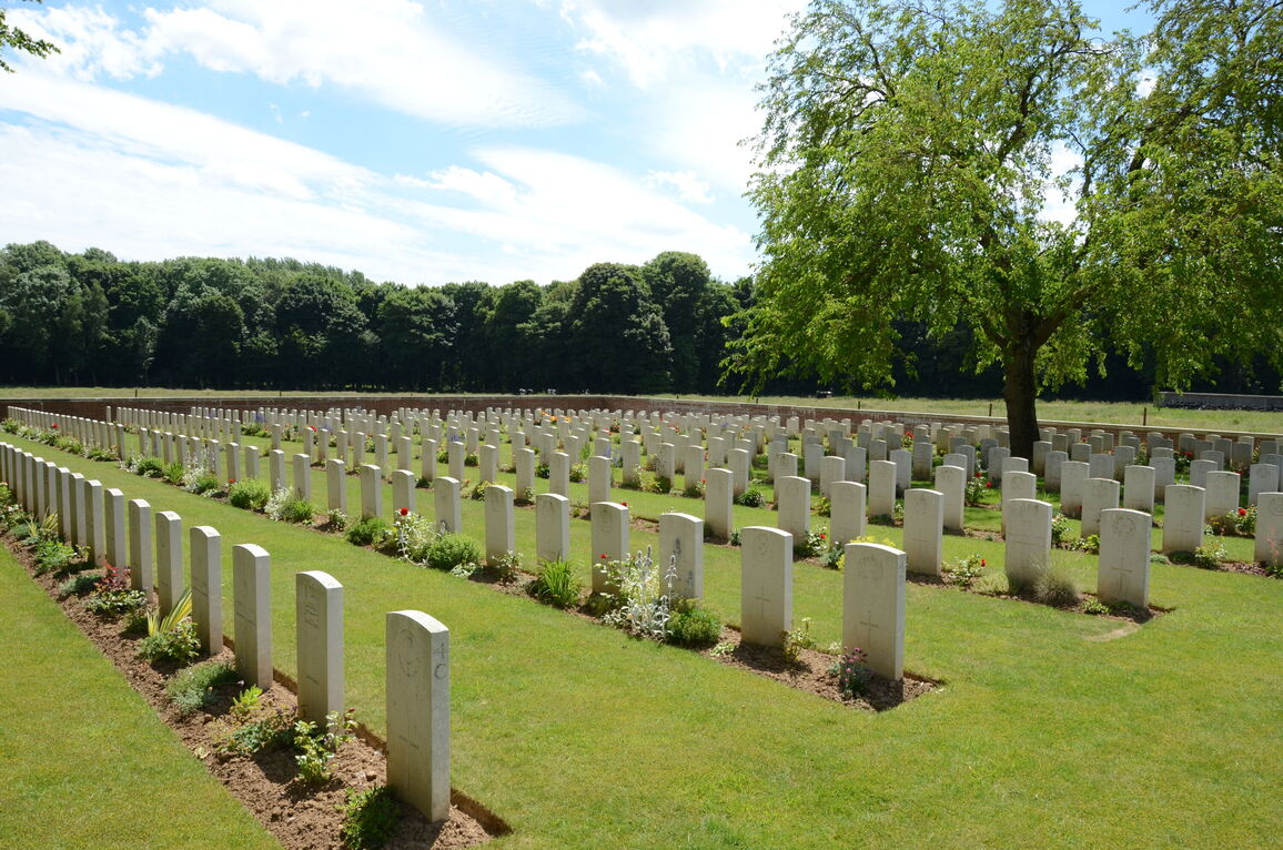
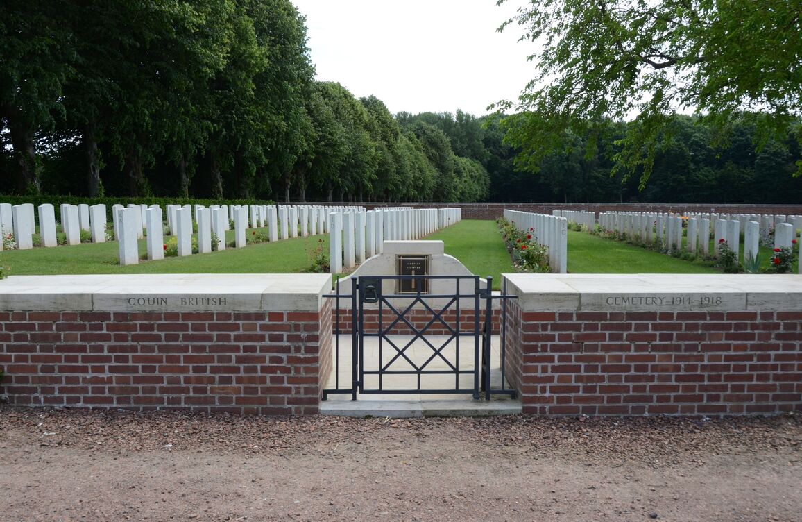
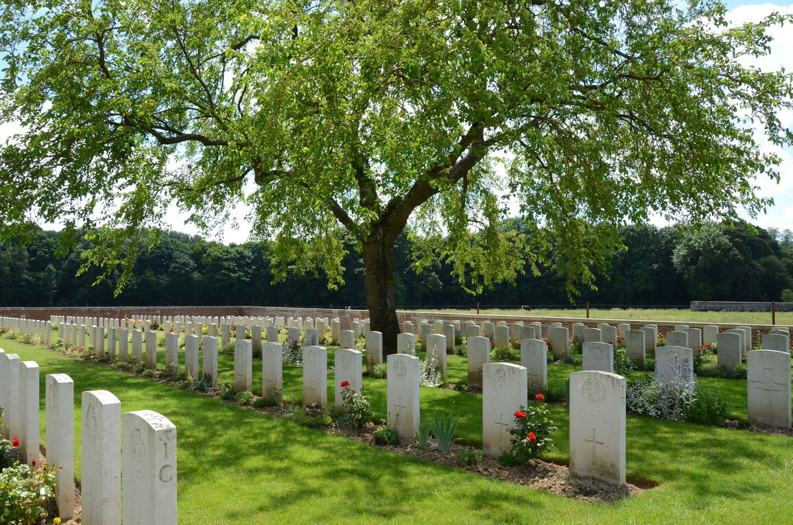
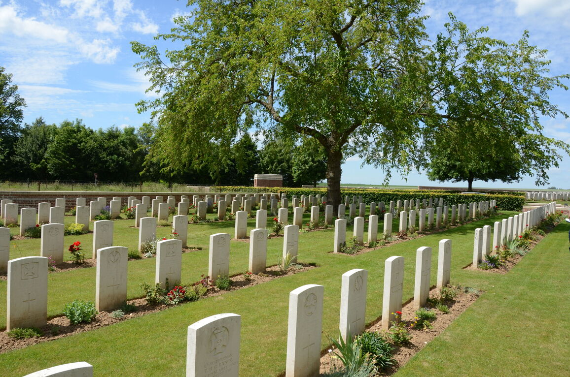
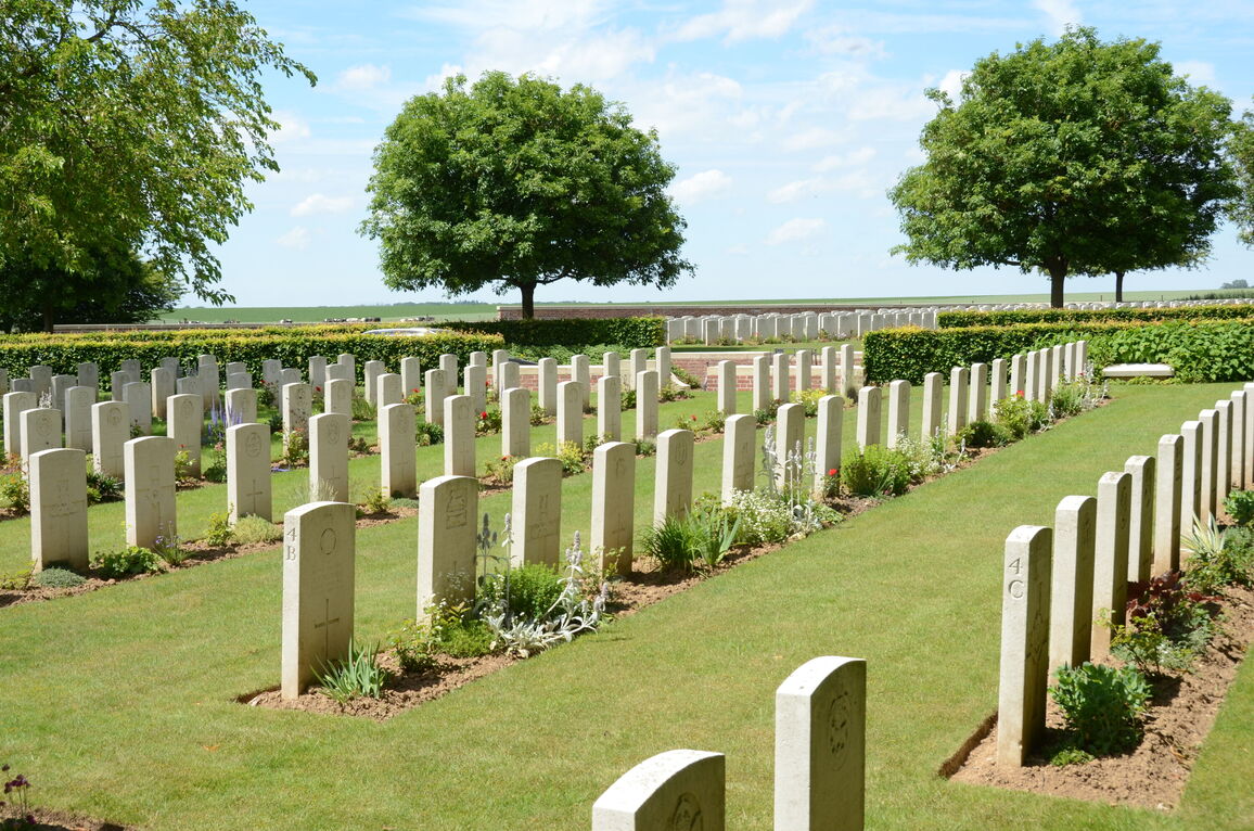
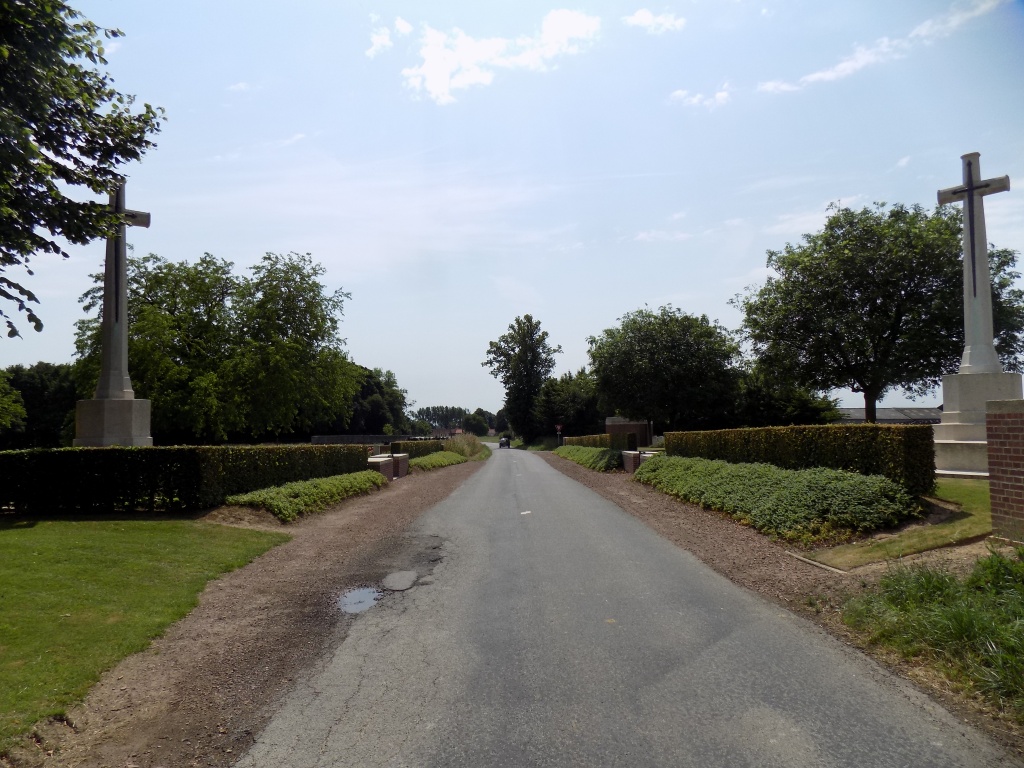
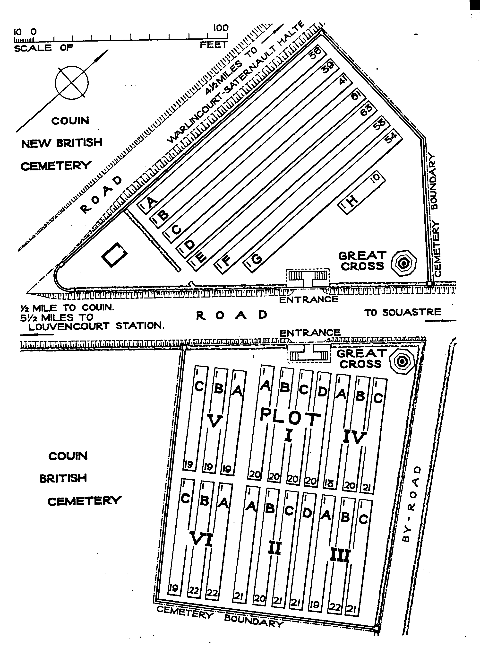
Couin British Cemetery
- Country France
- Total identified casualties 404 Find these casualties
- Region Pas de Calais
- Identified casualties from First World War
- GPS Coordinates Latitude: 50.13949, Longitude: 2.53331
PLEASE NOTE
Following an accident, work will soon be carried out on the perimeter wall.
Location information
Couin is a village 15 kilometres east of Doullens. Visitors should follow the main Doullens to Arras road, N25, as far as the crossroads with the D23. Follow the D23 to Souastre, then the D2 to Couin, as indicated by the CWGC sign. Couin British Cemetery and Couin New British Cemetery are at the side of the road just before entering the village.
Visiting information
Wheelchair access to site is possible, but may be by alternative entrance. For further information regarding wheelchair access, please contact our Enquiries Section on 01628 507200.
History information
Couin Chateau was used as a divisional headquarters from 1915 to 1918. The BRITISH CEMETERY was begun in May 1916 by the field ambulances of the 48th (South Midland) Division, and was used by units and field ambulances during the Battle of the Somme in 1916. It was closed at the end of January 1917 because further extension was not possible, and now contains 401 Commonwealth burials of the First World War and three German graves. The NEW BRITISH CEMETERY was opened across the road and was used by field ambulances from January 1917 (with a long interval in 1917-18) to the end of the war. One grave was moved there after the Armistice from a cemetery at Coigneux. It now contains 360 Commonwealth burials of the First World War and two German war graves. Both cemeteries were designed by Sir Reginald Blomfield.