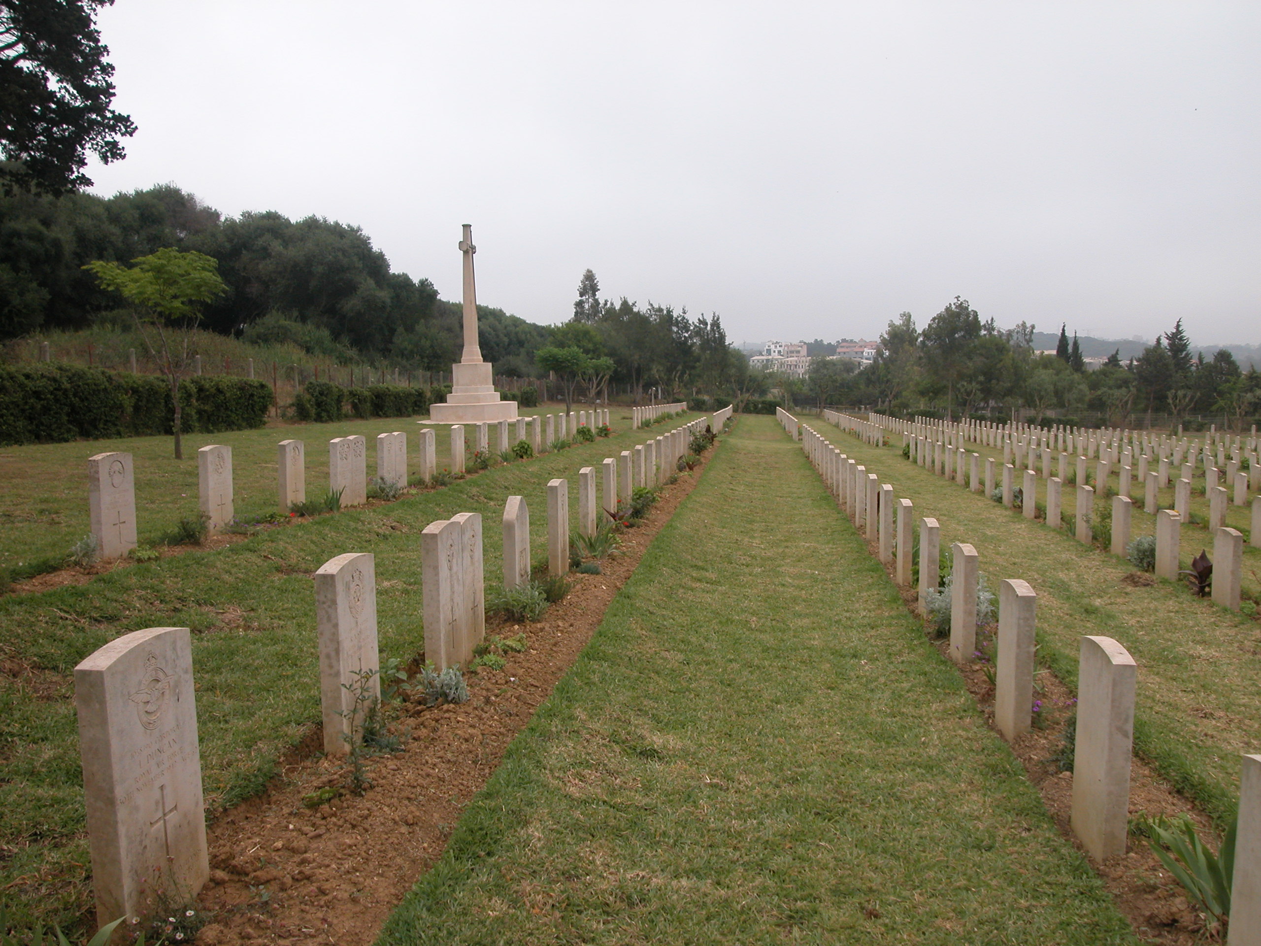
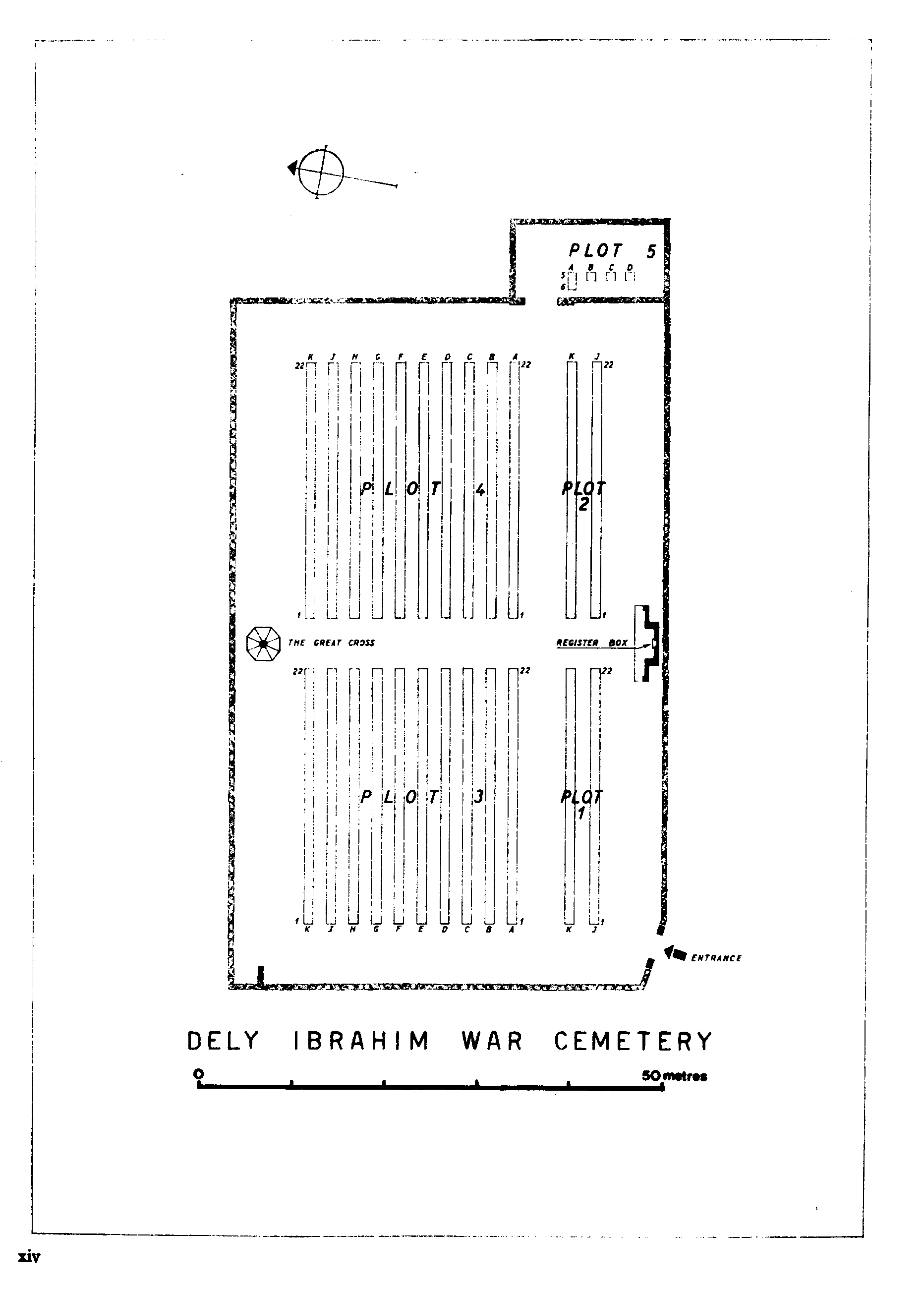
Dely Ibrahim War Cemetery
- Country Algeria
- Total identified casualties 493 Find these casualties
- Identified casualties from Second World War
- GPS Coordinates Latitude: 36.75073, Longitude: 2.9874
Location information
Dely Ibrahim is a suburb about 10 kilometres south-west of Algiers on the road to Blida. The War Cemetery is located just off the main road and next to the German Military Cemetery. GPS Co-ordinates: Latitude: 36.751045, Longitude: 2.987723.
Visiting information
Opening times:
Sunday to Thursday 8.00am to 4.00pm
Friday and Saturday: closed
The cemetery register and visitors book are not available outside of the working hours.
Please note that the cemetery gates are padlocked outside of the opening hours to prevent sheep from entering the cemetery and grazing. However the entrace gate is low, and it is possible to gain access by stepping over the gate. The gate can also be opened by entering the combination LUCK on the padlock.
Before considering a visit to Algeria the Commission strongly recommends that you check the advice given by the Foreign & Commonwealth Office on the travel section of their website: www.fco.gov.uk/en/travel-and-living-abroad/travel-advice-by-country/
For further information and enquiries please contact enquiries@cwgc.org
History information
Allied troops made a series of landings on the Algerian coast in early November 1942. From there, they swept east into Tunisia, where the North African campaign came to an end in May 1943 with the surrender of the Axis forces. Dely Ibrahim War Cemetery contains 494 Commonwealth burials of the Second World War and 11 war graves of other nationalities. There are also 25 non-war graves, mostly of merchant seamen whose deaths were not due to war service.