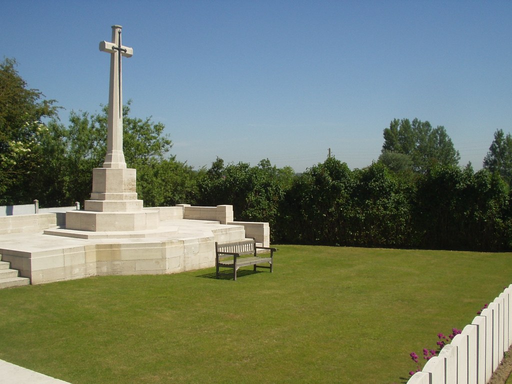
Lillers Communal Cemetery Extension
- Country France
- Total identified casualties 65 Find these casualties
- Region Pas de Calais
- Identified casualties from First World War
- GPS Coordinates Latitude: 50.56931, Longitude: 2.47765
Location information
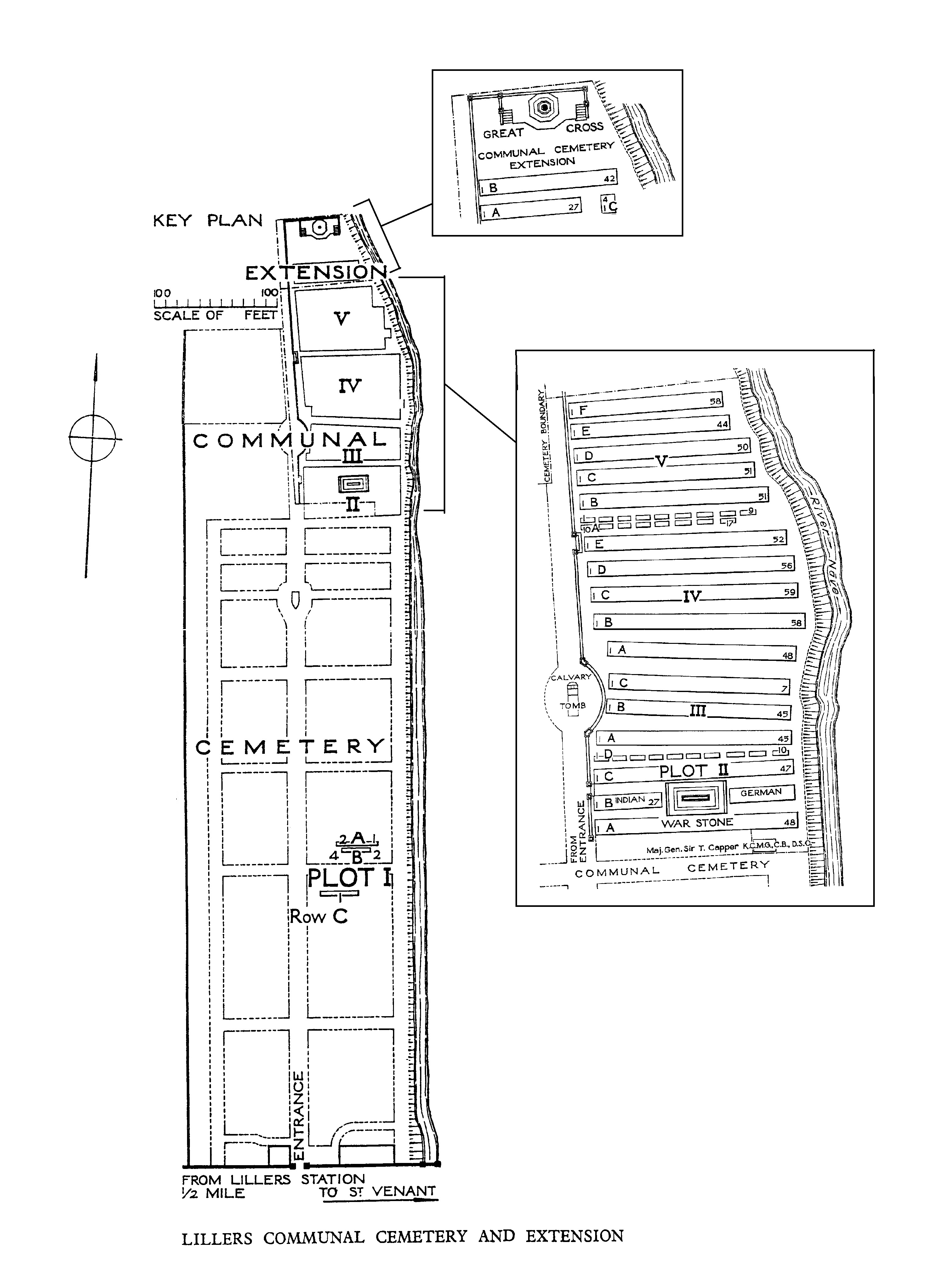
Lillers is a small town about 15 kilometres west-north-west of Bethune and the Communal Cemetery and Extension lie to the north of the town. From the Mairie in the centre of the town, head north on the D182, after 500 metres turn right onto Rue St Venant. The cemetery is a further 200 metres on the left hand side. Within the Communal Cemetery the Commonwealth war graves are situated on the right hand side half way up the cemetery central path, and the Extension is at the far right end of the Communal Cemetery. Both cemeteries are signposted.
Visiting information
Wheelchair access to the cemetery is possible, but may be by alternative entrance. For further information regarding wheelchair access, please contact our Enquiries Section on 01628 507200.
History information
Lillers was used for billets and headquarter offices from the autumn of 1914 to April 1918. At that time it was a hospital centre with the 6th, 9th, 18th, 32nd, 49th and 58th Casualty Clearing Stations in the town at one time or another. These units buried their dead on the right of the central path of the communal cemetery, working back from Plot I. In April 1918, the Germans advanced as far as Robecq; Lillers came under shell-fire, and the units holding this front continued to bury beyond the cemetery boundary, in the extension. The COMMUNAL CEMETERY contains 894 Commonwealth burials of the First World War, 67 of which are unidentified. There are also 15 German graves in the Commonwealth plots. The EXTENSION contains 71 Commonwealth burials of the First World War, six of them unidentified.