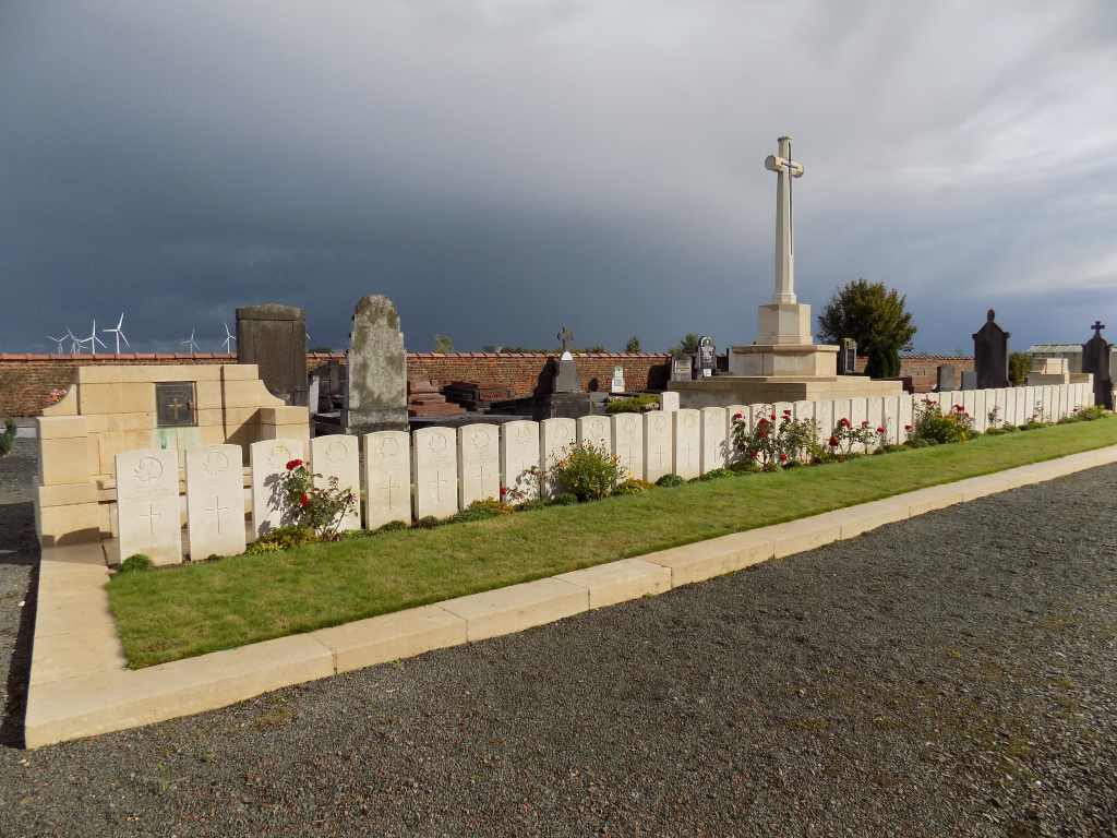
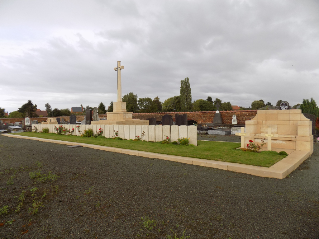
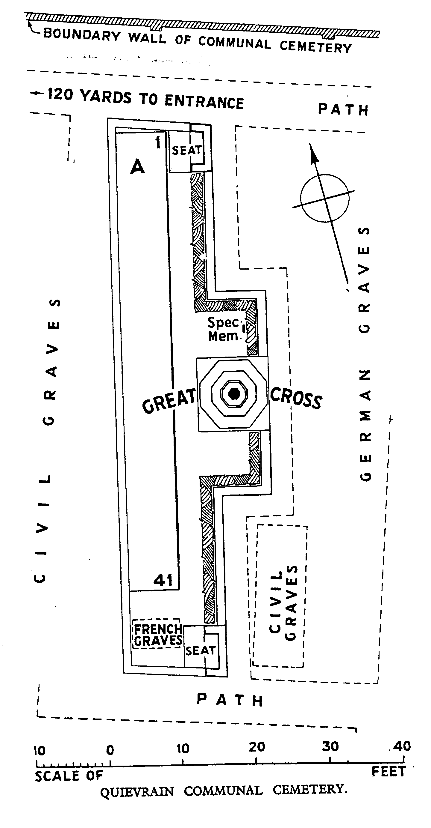
Quievrain Communal Cemetery
- Country Belgium
- Total identified casualties 43 Find these casualties
- Region Hainaut
- Identified casualties from First World War
- GPS Coordinates Latitude: 50.40278, Longitude: 3.6874
Location information
Quievrain Communal Cemetery is located 20 km west of Mons on a road leading from the N51 which connects Mons to Quievrain and on to Valenciennes. The N51 Rue Grande passes directly through the village of Quievrain and forms a junction with the Rue des Wagons in the centre of the village. The Rue des Wagons leads for 500 metres (towards the village of Baisleux) and to the left hand turning onto the Rue du Chateau D'Eau. The cemetery is located 400 metres along this road and at the junction with the Rue du Cheval Blanc.
Visiting information
The British plot is enclosed by a stone curb. Visitors should note that this site is restricted to normal cemetery opening hours. Wheelchair access to the cemetery is possible via main entrance. For further information regarding wheelchair access, please contact our Enquiries Section on telephone number: 01628 507200.
History information
In 1914, the Belgian Red Cross established a hospital, taken over later by the Germans, at Quievrain. The Commonwealth plot in the communal cemetery was begun in November 1918, and after the Armistice the graves of prisoners of war buried by the Germans elsewhere in the cemetery were moved into it. The cemetery now contains 43 Commonwealth burials of the First World War.