Lijssenthoek Military Cemetery
- Country Belgium
- Total identified casualties 10124 Find these casualties
- Region West-Vlaanderen
- Identified casualties from First World War
- GPS Coordinates Latitude: 50.82839, Longitude: 2.7016
PLEASE NOTE
The side wings of the entrance building are not accessible due to stability issues.
Location information
Lijssenthoek Military Cemetery is located 12 Kms west of Ieper town centre, on the Boescheepseweg, a road leading from the N308 connecting Ieper to Poperinge. From Ieper town centre the Poperingseweg (N308) is reached via the Elverdingestraat, then over two small roundabouts in the J. Capronstraat. The Poperingseweg is a continuation of the J. Capronstraat and begins after a prominent railway level crossing. On reaching Poperinge, the N308 joins the left hand turning onto the R33, Poperinge ring road. The R33 ring continues to the left hand junction with the N38 Frans-Vlaanderenweg. 800 metres along the N38 lies the left hand turning onto Lenestraat. The next immediate right hand turning leads onto Boescheepseweg. The cemetery itself is located 2 Kms along Boescheepseweg on the right hand side of the road.
Visiting information
ARRIVAL
Routes to the cemetery are signposted. The Visitor Centre Car Park is also signposted.
The main entrance is a red brick and white stone memorial archway at the side of the main road, Boescheepseweg.
There is a paved footpath alongside the road in front of the cemetery, with a low steel wall on the roadside. The pathway provides access to the cemetery from the car park, located behind the visitor centre, a distance of approximately 275 metres. The pathways are level and paved the entire length.
PARKING
There is a large car park located behind the Visitor’s Centre. Step-free access to the cemetery is possible via a side entrance near the car park.
It is not possible to park in front of the main entrance of the cemetery.
ACCESS, LAYOUT AND MAIN ENTRANCE
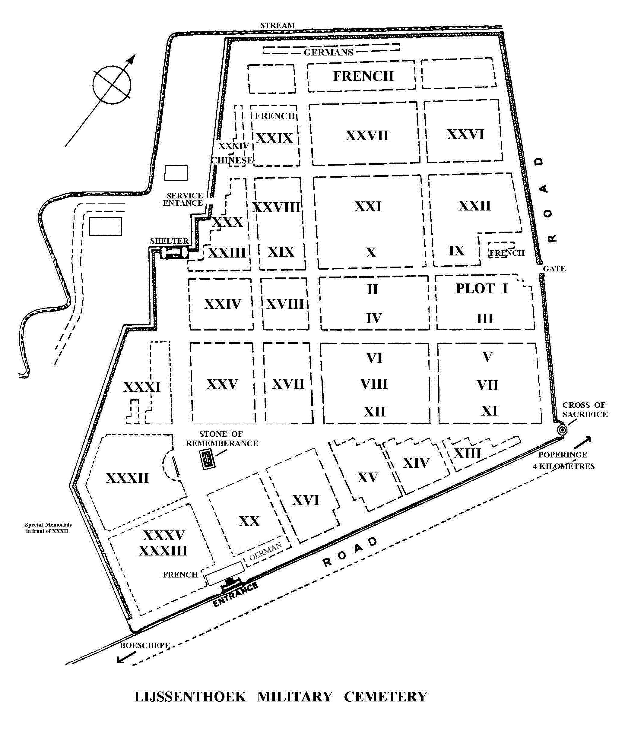
The cemetery is rectangular in shape with the front wall of the cemetery (southeastern) along the main road, the northeast wall along the boundary road adjacent to the Visitor Centre, the southwest boundary alongside the access road for the cemetery base site (staff building), and the northwest boundary along the rear of the site.
The main entrance building is adjacent to the main road at the southern end of the cemetery. There is a small gravel topped area in front of 9 stone steps that lead up to a large arched metal gate.
The tall metal gates are over 2 metres tall and open outwards. The right-side gate leaf is normally open, allowing a clear space of 1 metre.
The paving inside the entrance building is level with the grass as you enter the cemetery. On either side of the main entrance are two side rooms. It is possible to access the cemetery from these two rooms into the cemetery. There are doorways at either end of the building which lead onto stone platforms. 2 steps lead down from the platforms into the cemetery.
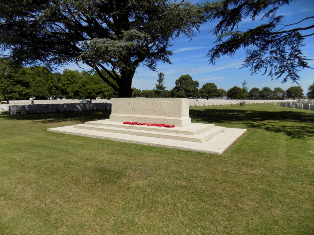
The Cross of Sacrifice is in the eastern corner of the cemetery built into the to the end of the perimeter wall along the main road. The Cross is on an elevated platform which is accessible by climbing five steps up onto a paved level platform.
The Stone of Remembrance is located opposite the main entrance, approximately forty metres from the entrance, in line with the memorial shelter building, midway along the southwest boundary of the cemetery near the staff building.
The shelter building, located along the southwest side of the cemetery, is accessed by climbing 4 steps up to the interior, between two stone columns. There is a stone bench along the back wall of the shelter.
The Register Box is located inside the main entrance building, on the left side of the main entrance.
There are multiple timber bench seating areas within the cemetery.
All internal paths are grass, the ground is firm but can be undulating in places.
ALTERNATIVE ACCESS
There is an additional entrance into the cemetery close to the Visitor Centre car park. A paved road runs alongside the boundary wall of the cemetery, adjacent to the Visitor Centre. Access to the paved road is from the pathway that leads to the main road from the Visitor Centre. Follow the paved road from the Cross of Sacrifice, along the outside wall of the cemetery to the gate midway along the boundary.
There is a 2.0 metre wide, waist-high double gate at the midpoint of the cemetery wall. The right-side leaf is latched and opens inwards directly into the cemetery. The left side leaf can also be opened if required. The is a vertical handle at the bottom of the gate.
ADDITIONAL INFORMATION
The cemetery is permanently open.
The Visitor Centre is open daily from 0900 hrs to 1800 hrs. There are toilets available in the Visitor Centre
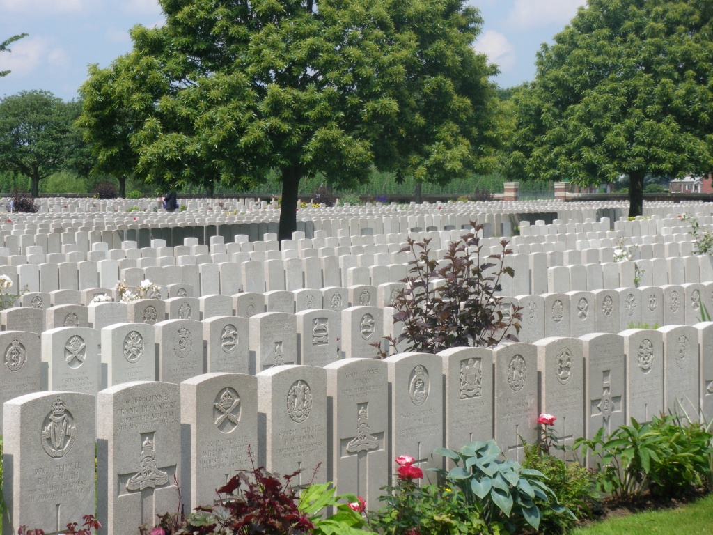
Please note, in some rows there are two headstones per grave, which can cause confusion when counting headstones to find a grave. If a headstone is not found by counting headstones, then we suggest continuing to look further along the row as for instance, the headstone for grave 10 could be 19th or 20th headstone in the row.
History information
During the First World War, the village of Lijssenthoek was situated on the main communication line between the Allied military bases in the rear and the Ypres battlefields. Close to the Front, but out of the extreme range of most German field artillery, it became a natural place to establish casualty clearing stations. The cemetery was first used by the French 15th Hopital D'Evacuation and in June 1915, it began to be used by casualty clearing stations of the Commonwealth forces.
From April to August 1918, the casualty clearing stations fell back before the German advance and field ambulances (including a French ambulance) took their places.
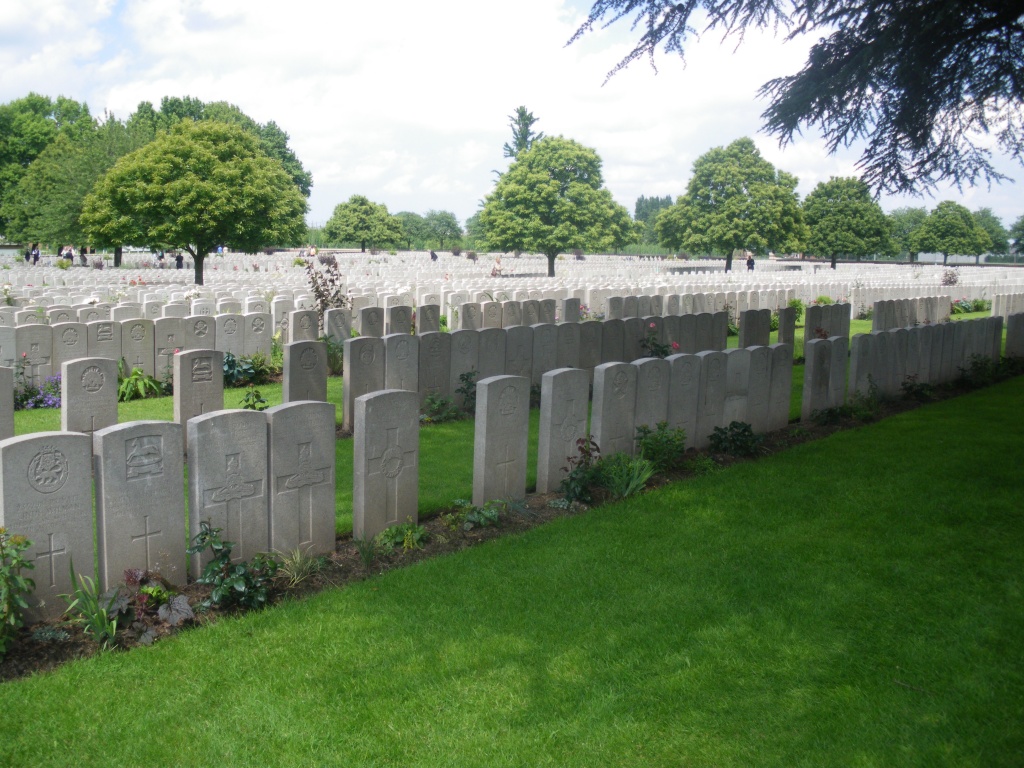
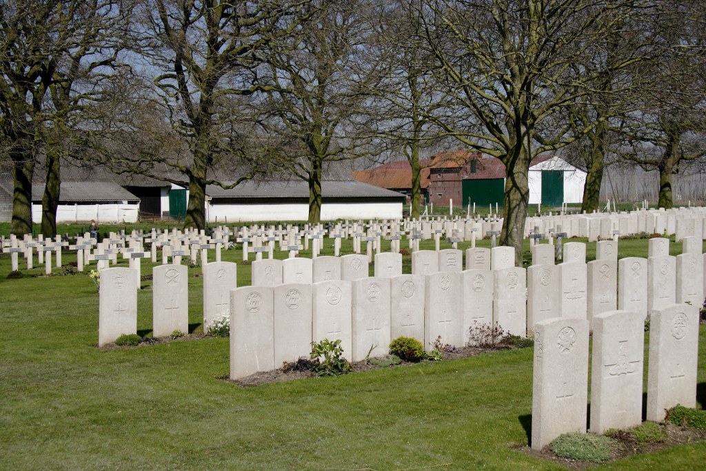
The cemetery contains 9,901 Commonwealth burials of the First World War, 24 being unidentified. There are 883 war graves of other nationalities, mostly French and German, 11 of these are unidentified. There is 1 Non World War burial here.
The only concentration burials were 24 added to Plot XXXI in 1920 from isolated positions near Poperinghe and 17 added to Plot XXXII from St. Denijs Churchyard in 1981.
Eight of the headstones are Special Memorials to men known to be buried in this cemetery, these are located together alongside Plot 32 near the Stone of Remembrance.
The cemetery, designed by Sir Reginald Blomfield, is the second largest Commonwealth cemetery in Belgium.