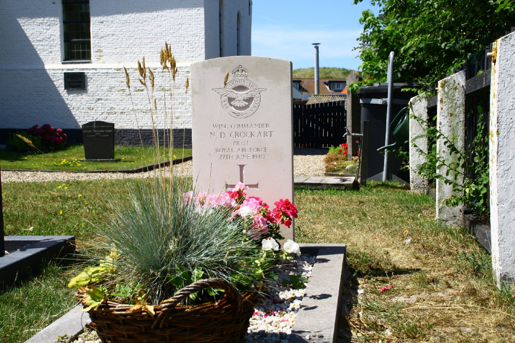
Callantsoog Churchyard
- Country Netherlands
- Total identified casualties 1 Find these casualties
- Region Noord-Holland
- Identified casualties from Second World War
- GPS Coordinates Latitude: 52.83488, Longitude: 4.69345
Location information
Callantsoog is a village and commune 27 kilometres north of Alkmaar, and 17 kilometres south-south-west of Den Helder. It lies 5 kilometres west of the main Alkmaar-Den Helder road. The church stands in Kerkplein, a turning off of Zeeweg. The churchyard lies behind the church, in the southern part of the village. In its north-eastern corner is the grave.