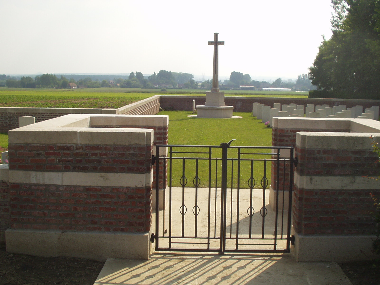
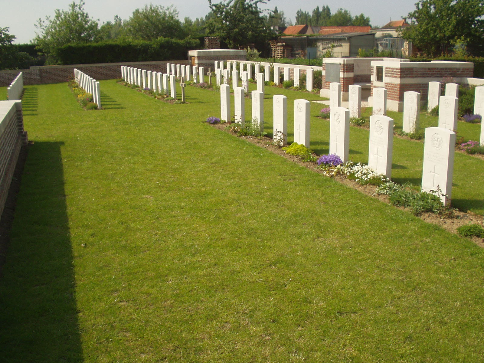
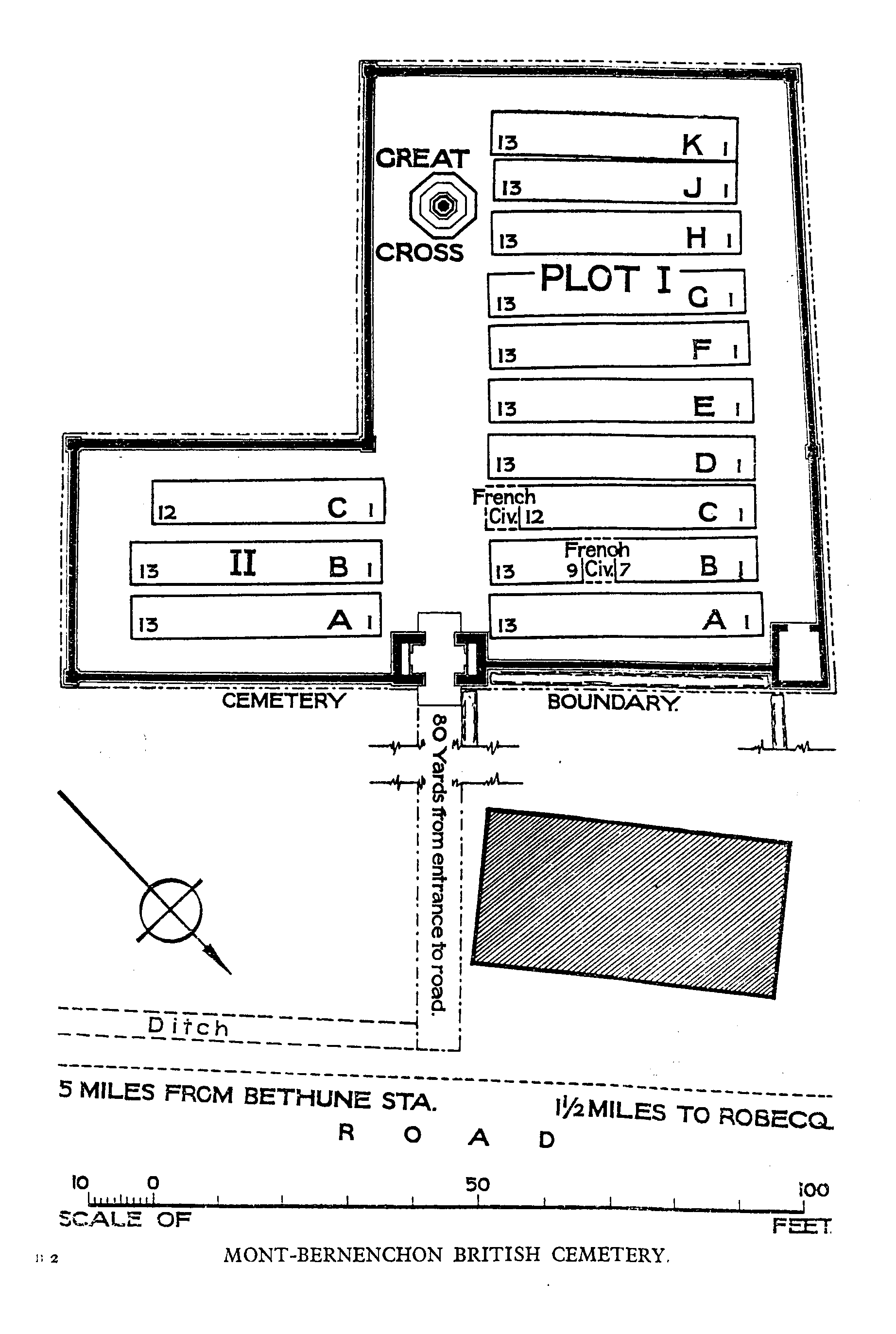
Mont-Bernanchon British Cemetery, Gonnehem
- Country France
- Total identified casualties 168 Find these casualties
- Region Pas de Calais
- Identified casualties from First & Second World War
- GPS Coordinates Latitude: 50.57915, Longitude: 2.58493
Location information
Mont-Bernanchon (also spelt as Mont-Bernenchon) is a village 8 kilometres north-north-west of Bethune. From Bethune follow the D937 road in the direction of Hazebrouck. About 6 kilometres along this road is the village of Mont Bernanchon. Just before you enter the village the Cemetery lies on the left hand side of the road, set back along a chemin d'access, approximately 100 metres from the roadside.
History information
In April 1918, the German advance on the Lys was checked and stopped a little to the east of the village. The cemetery was begun by the 2nd Lancashire Fusiliers in April 1918 and used by fighting units and the XIII Corps Burial Officer until August 1918.
Mont-Bernanchon saw fighting again during the Second World War. In late May 1940 units of the British Expeditionary Force fought a fierce and stubborn rearguard action in defence of the canal banks (the Aire-La Bassee canal is just north of the village) in order to hold up the German advance and aid the withdrawal to Dunkirk for evacuation.
Mont-Bernanchon British Cemetery contains 166 First World War burials and two from the Second World War.
The cemetery was designed by W H Cowlishaw.