Chiswick Old Cemetery
- Country United Kingdom
- Total identified casualties 71 Find these casualties
- Region Middlesex
- Identified casualties from First & Second World War
- GPS Coordinates Latitude: 51.48353, Longitude: -0.2541

Location information
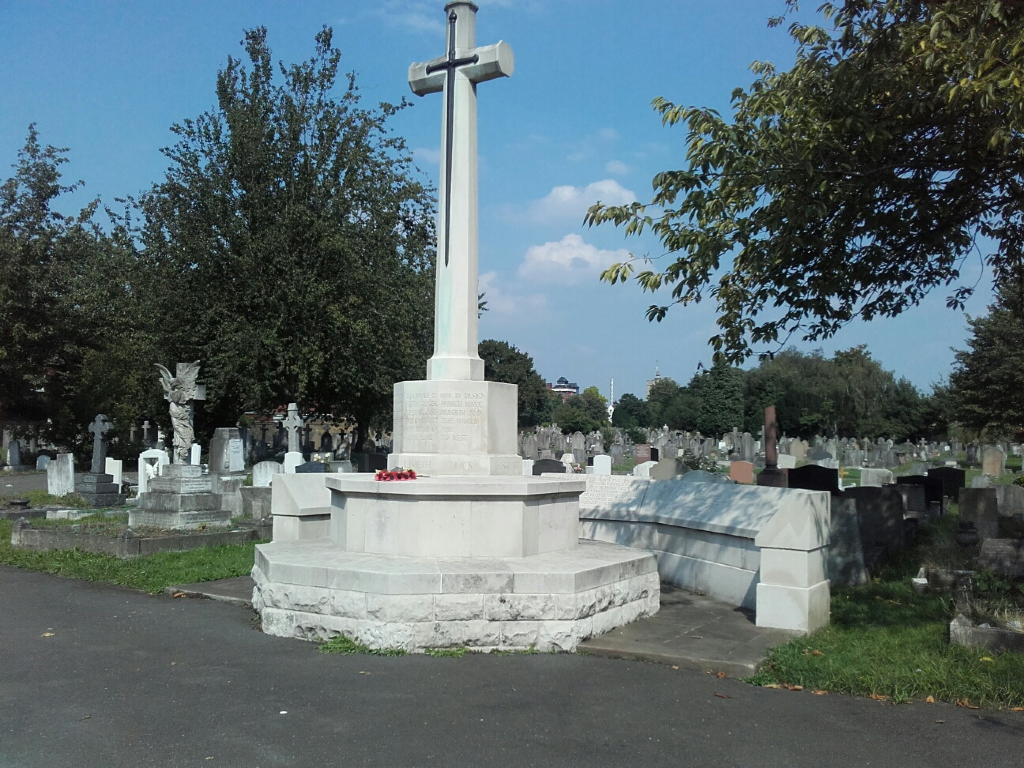
The cemetery lies between St. Nicholas Churchyard and Corney Road, near the river. It belongs to the Urban District Council. It contains scattered War Graves and a War Cross is erected facing the Corney Road entrance, backed by a screen wall bearing the names of those whose graves are not marked by headstones.