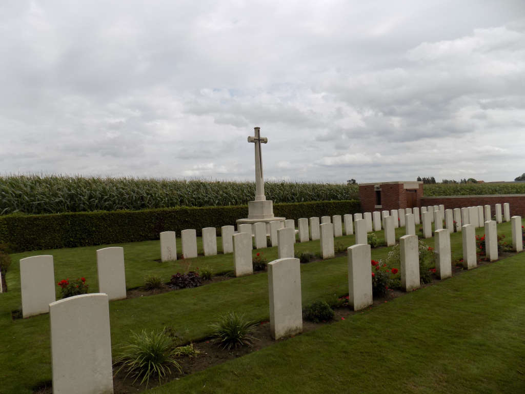
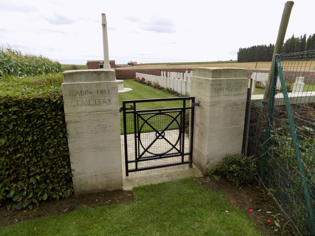
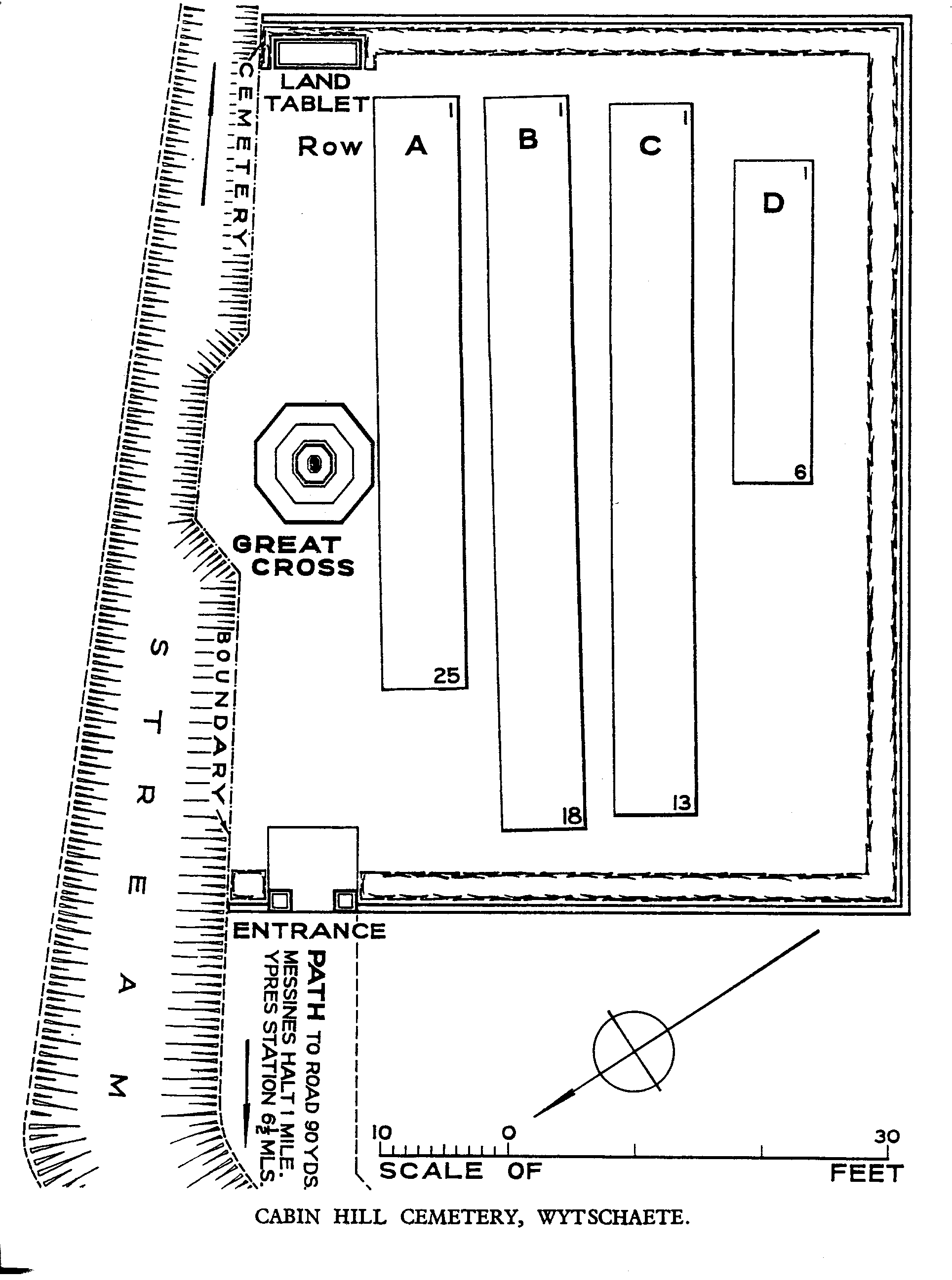
Cabin Hill Cemetery
- Country Belgium
- Total identified casualties 67 Find these casualties
- Region West-Vlaanderen
- Identified casualties from First World War
- GPS Coordinates Latitude: 50.77405, Longitude: 2.90484
Location information
Cabin Hill Cemetery is located 8.5 km south of Ieper town centre on a road leading from the Rijselseweg (N365) connecting Ieper to Wijtschate and on to Armentieres. From Ieper town centre the Rijselsestraat runs from the market square, through the Lille Gate (Rijselpoort) and directly over the crossroads with the Ieper ring road. The road name then changes to the Rijselseweg, (N336). After 4 km the N336 road forks with the N365 towards Wijtschate. On passing through the village of Wijtschate, there lies a left hand turning onto a street called Langebunderstraat. Langebunderstraat leads towards Torreken Farm Cemetery and beyond reaching a crossroads after 1.5 km Cabin Hill Cemetery is located 100 metres beyond the crossroads, having taken the left hand turning. Visitors this site should note a small grassed access path to this cemetery which is unsuitable for vehicles.
Visiting information
Wheelchair access possible via main entrance. For further information regarding wheelchair access, please contact our Enquiries Department on telephone number: 01628 634221
History information
Wytschaete (now Wijtschate) was taken by the Germans early in November 1914. It was recovered by Commonwealth forces during the Battle of Messines on 7 June 1917, but fell into German hands once more on 16 April 1918. The village was recovered for the last time on 28 September. Cabin Hill Cemetery was begun by the 11th Division in June 1917 and used as a front line cemetery until March 1918. The cemetery contains 67 First World War burials. The cemetery was designed by N A Rew.