Tourgeville Military Cemetery
- Country France
- Total identified casualties 292 Find these casualties
- Region Calvados
- Identified casualties from First & Second World War
- GPS Coordinates Latitude: 49.33991, Longitude: 0.06901
Location information
Tourgeville is a commune adjoining the town of Deauville, which is located on the coast at the mouth of the River Touques, just south of Le Havre. The Military Cemetery is situated north of the village of Tourgeville, in the region of Mont Canisy. The Cemetery is located on Chemin du Cimetiere Militaire, approximately 250 metres west of the junction with Chemin du Val Martin.
Visiting information
ARRIVAL
The route to the cemetery is signposted. A CWGC Cemetery direction sign is located at the junction of Chemin du Val Martin and Chemin du Cimetiere Militaire. The cemetery is approximately 250 metres west of the junction.
PARKING
There is a parking area with two paved spaces for vehicles off to the edge of a single lane road (Chemin du Cimetiere Militaire), close to the bottom end of the cemetery.
The parking area is thirty metres from the main entrance and approximately three metres from a steep grass ramp leading up to the cemetery from the road.
ACCESS LAYOUT AND MAIN ENTRANCE
The cemetery is on a slope. The slope is gentle but there is a steep grass verge with a steep 1.20 metre drop to the road that runs along the edge of the cemetery. The cemetery slopes upwards from the road side to the rear of the site.
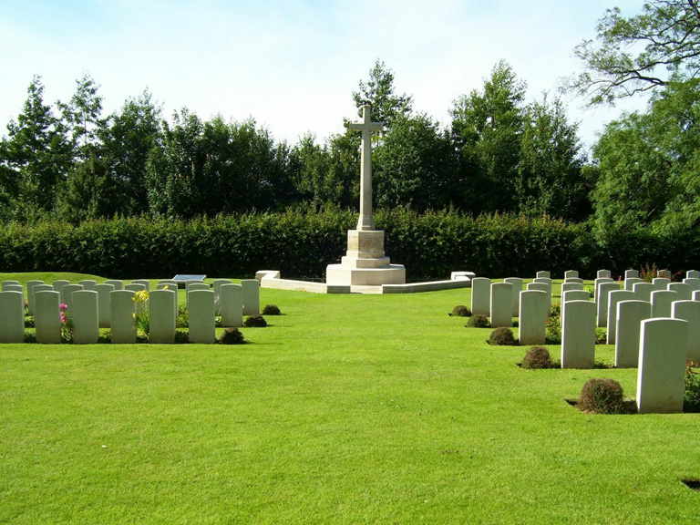
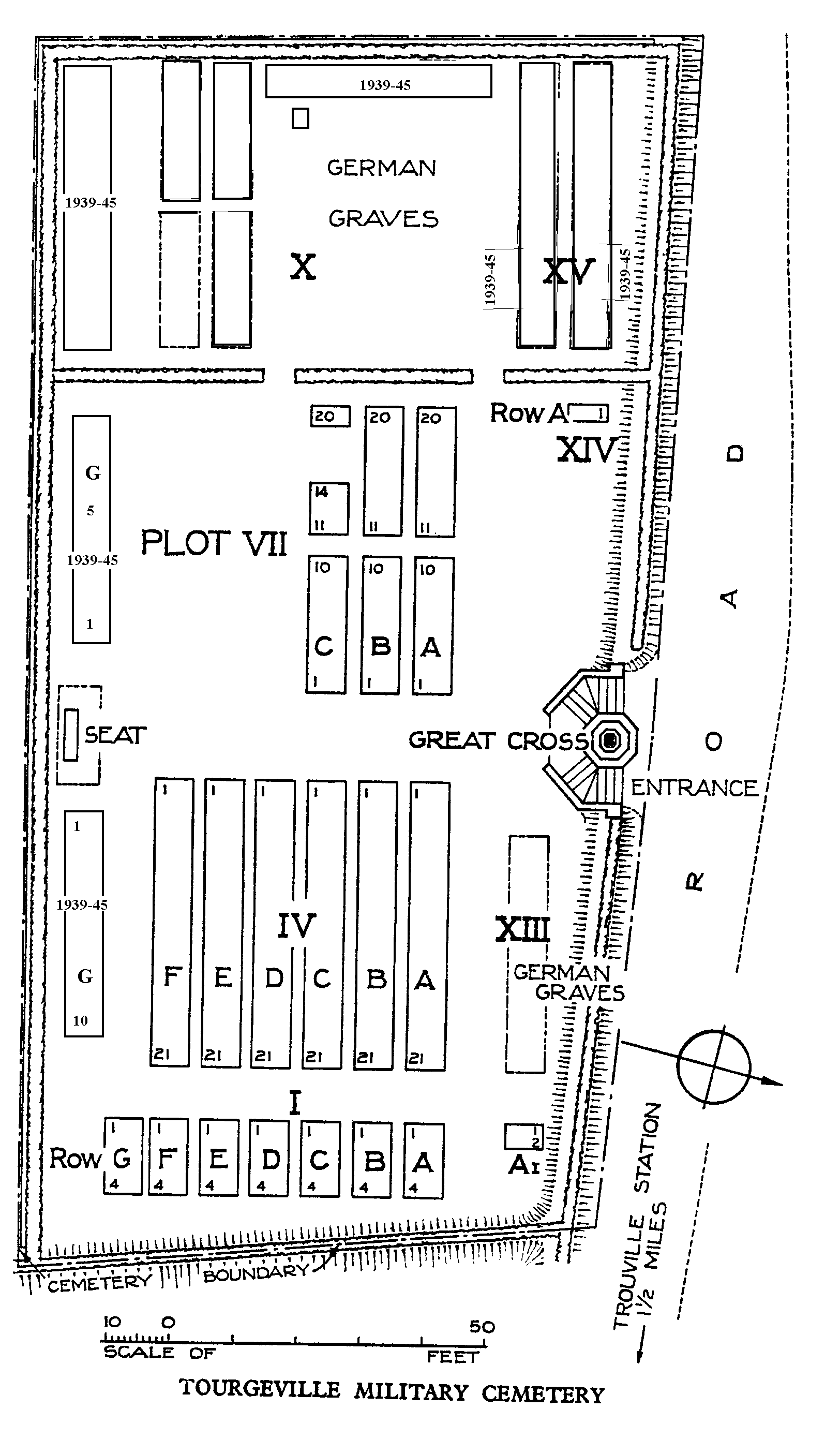
The main gate has two 1.20 metre wide (two 600 mm sections) latched, black metal, mid-level (thigh height) gates. The gates are located on each side of the Cross of Sacrifice and open outwards away from the bottom tread of the curved steps leading up into the cemetery. The Gates are located on the first step, approximately 150 mm above the gravel frontage of the entrance.
The Cross of Sacrifice is in the middle of the main entrance. There are six stone steps curving around the Cross of sacrifice on both sides, which lead up to the burial area.
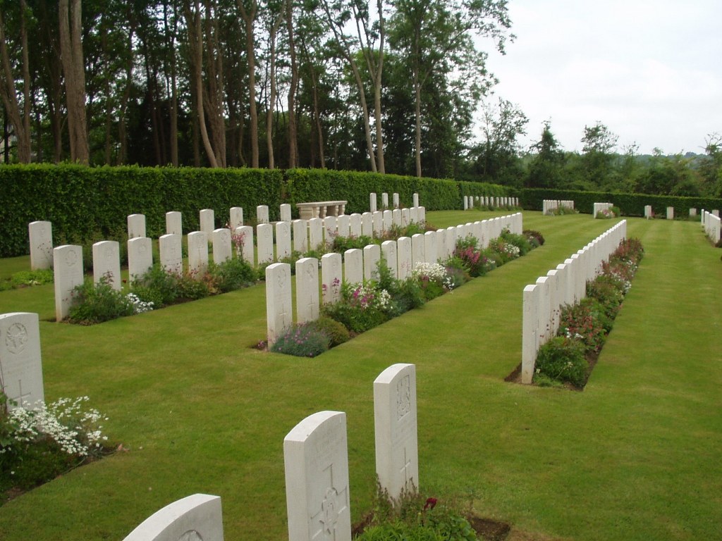
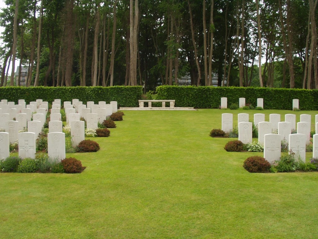
The cemetery ground surface is firm, all the internal paths are grass.
There is a seating area with stone bench at the rear of the site, in line with the Cross of Sacrifice. The bench is raised on a stone platform with two stone steps up to the bench.
The Register Box is built into the entrance wall on the left side of the main entrance.
ALTERNATIVE ACCESS
Alternative access is available, thirty metres to the west of the main entrance, opposite the parking area.
A steep grass ramp leads up to the cemetery, approximately one-metre wide. There is a steep drop on the left side of the ramp (roadside).
ADDITIONAL INFORMATION
The cemetery is permanently open.
History information
The 14th Convalescent Depot was at Trouville in October 1917 and the Trouville Hospital Area - which later comprised the 72nd, 73rd and 74th General Hospitals, and the 13th, 14th and 15th Convalescent Depots - was established in February 1918.
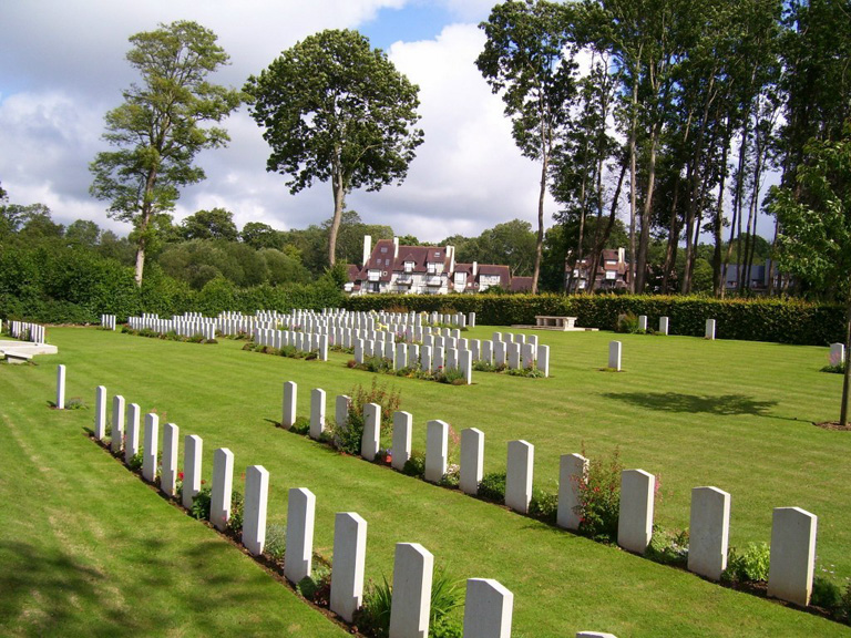
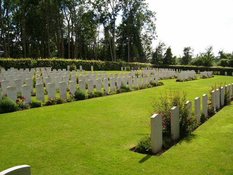
Tourgeville Military Cemetery contains 210 Commonwealth burials of the First World War and 13 from the Second World War. There are also 90 German graves and two non war burials.
The cemetery was designed by Sir Reginald Blomfield.